
Aerospace Controls Laboratory



Yixuan (Lucas) Jia , Andy Li
Autonomous off-road navigation requires robots to estimate terrain traversability from onboard sensors and plan motion accordingly. Conventional approaches typically rely on sampling-based planners such as MPPI to generate short-term control actions that aim to minimize traversal time and risk measures derived from the traversability estimates. These planners can react quickly but optimize only over a short look-ahead window, limiting their ability to reason about the full path geometry, which is important for navigating in challenging off-road environments. Moreover, they lack the ability to adjust speed based on the terrain-induced vibrations, which is important for smooth navigation on challenging terrains. In this paper, we introduce TRAIL (Traversability with an Implicit Learned Representation), an off-road navigation framework that leverages an implicit neural representation to model terrain properties as a continuous field that can be queried at arbitrary locations. This representation yields spatial gradients that enable integration with a novel gradient-based trajectory optimization method that adapts the path geometry and speed profile based on terrain traversability.
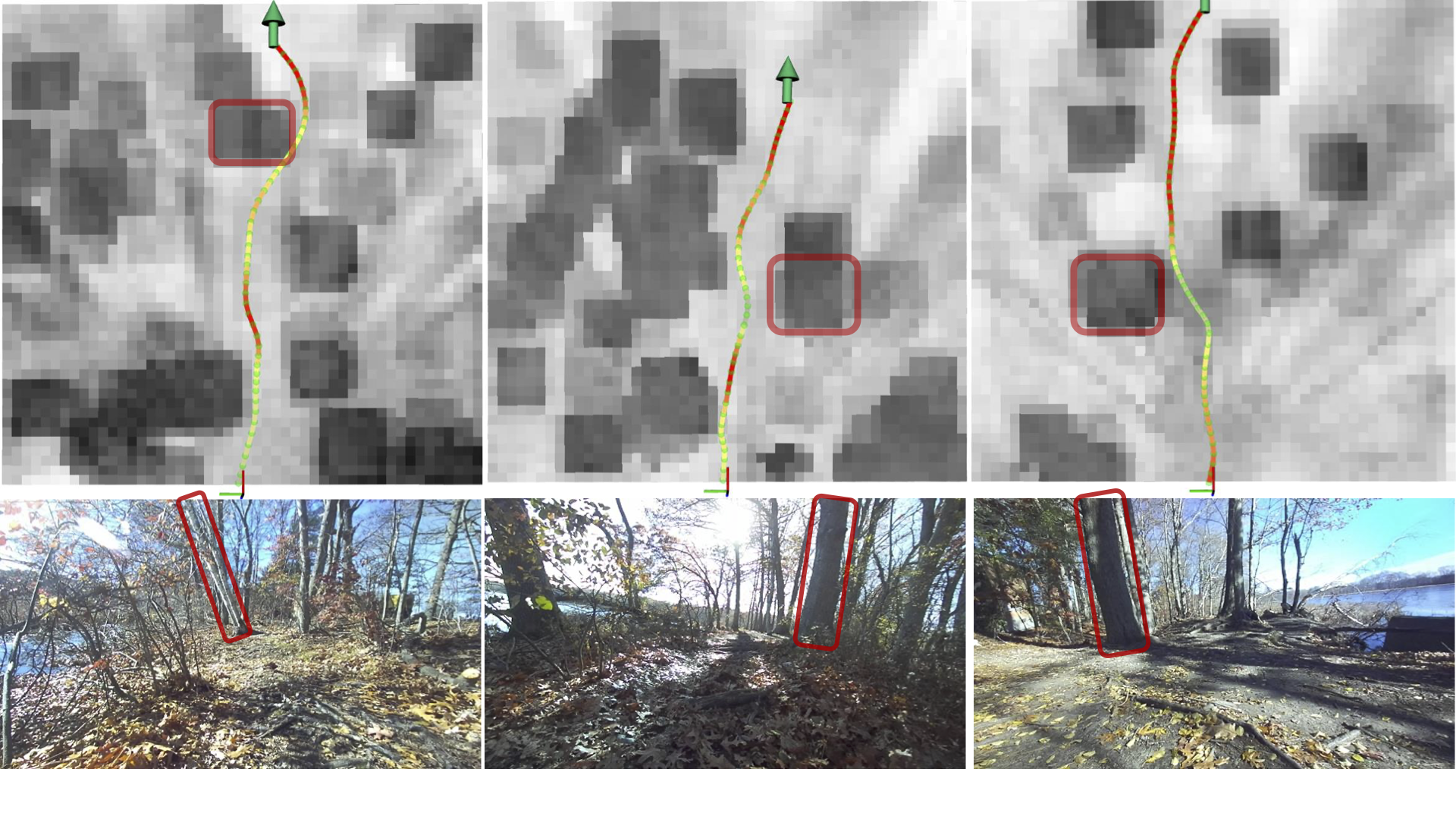 Top: Optimized trajectories overlaid on the blended cost map, generated by combining two cost maps with 50% transparency (sampled at fixed grid resolution for visualization). The larger dark blocks represent higher geometric risk inflated using vehicle radius (e.g. the highlighted tree trunks) while finer greyscale variations correspond to predicted terrain bumpiness (e.g. grey regions around trees from tree roots). Redder trajectory segments indicate higher speed.
Bottom: Corresponding onboard camera images.
The optimized trajectories avoid hard obstacles, slow down when approaching bumpy regions, and speed up in smoother areas.
Top: Optimized trajectories overlaid on the blended cost map, generated by combining two cost maps with 50% transparency (sampled at fixed grid resolution for visualization). The larger dark blocks represent higher geometric risk inflated using vehicle radius (e.g. the highlighted tree trunks) while finer greyscale variations correspond to predicted terrain bumpiness (e.g. grey regions around trees from tree roots). Redder trajectory segments indicate higher speed.
Bottom: Corresponding onboard camera images.
The optimized trajectories avoid hard obstacles, slow down when approaching bumpy regions, and speed up in smoother areas.